blah blah blah
Rose Mountain and The Pinnacle
Length: 4.3 miles out-and-back with loopDifficulty (click for info): Easy
Elevation Gain: 720 feet (+160 feet on return)
Rating (click for info): 6/10
Elevation: 1723' (Rose) and 1689' (Pinnacle)
Prominence: 868' (Rose) and 149' (Pinnacle)
Driving Directions:
Trailhead is on Old Mountain Road in Lyndeborough, NH. From the center of Mont Vernon, drive 5 miles northwest from Rt. 13 on the Francestown Turnpike/Second NH Turnpike. Or, from the center of Francestown, drive southeast on the Second NH Turnpike for 4.2 miles. Turn southwest onto Schoolhouse Road, which bears left and becomes New Road after 0.1 miles. Continue another 0.4 miles, then proceed across a four-way at an angle to the left, staying on New Road. Continue another 2.5 miles to the indistinct center of Lyndeborough. Turn right onto Center Road for 0.3 miles, then take the next right onto Mountain Road. Go 0.1 miles and bear right at the fork, still on Mountain Road. The trailhead is on the left after 2.0 miles. Look for it not far before the top of the hill. There is no sign, but it enters the woods at a telephone pole across from the driveway to house #444. There is space for a couple cars to pull off on the near side of a bridge just before the trailhead. Click here for a Google map.
About the Hike:
Rose Mountain is not a familiar name in the canon of southern NH hiking, but it is a significant peak nonetheless. With a prominence of almost 900 feet, it is the highest point between Crotched Mountain and the Wapack Range. A broad mountain with three named summits on its 3/4-mile long ridge, including The Pinnacle on the far end from the main summit, Rose Mountain is accessible by a winding snowmachine trail that doubles as a hiking path. The first part of the hike to The Pinnacle is on an unofficial footpath, with relatively few visitors. Both summits reward visitors with pleasant views of rolling southern lands and enjoyable solitude.
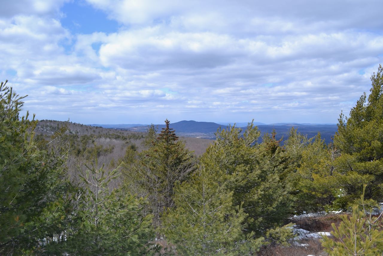
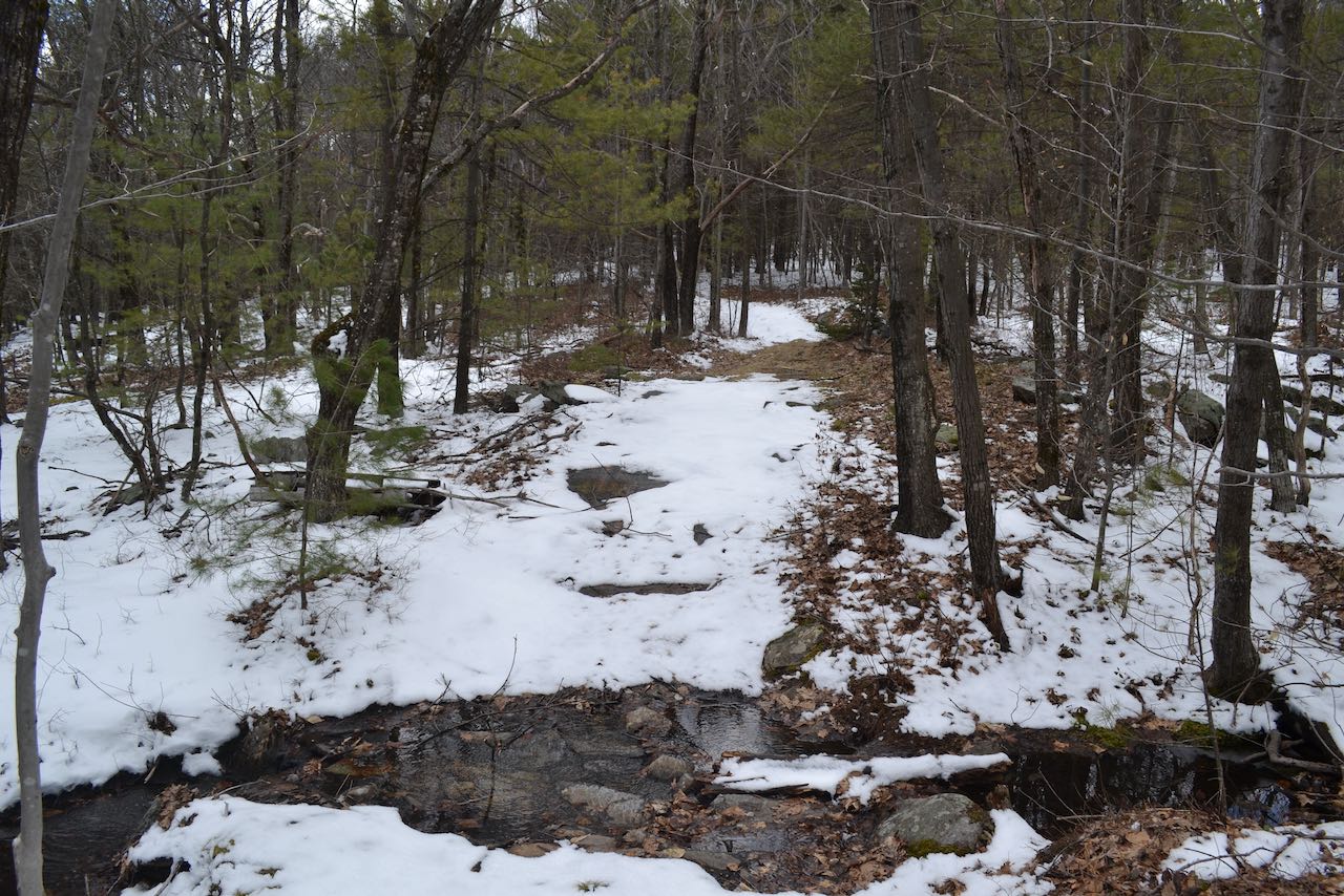
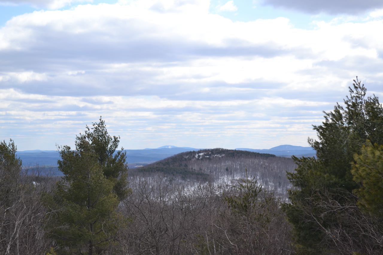
Head up into the woods on the unmarked path, which follows a stone wall near the gully of a brook, then swings to the right and crosses a flat area. After dipping to cross a smaller brook, you will reach the junction for the loop trail over The Pinnacle at 0.3 miles from the start. A sign indicates the split toward the less-used right fork. Bear left, taking the loop clockwise. The trail ramps up the hillside, becoming moderately steep as it climbs beneath a covering of conifers. It levels off and soon reaches a spacious clearing of ledge and grass, where a bit of a view opens in between the trees to the east. This is one of two knobs of identical elevation on the top of The Pinnacle. Continue straight across the clearing as a shortcut takes off to the right. As you loop around the summit, you will come to a ledge where clearing has been done to open up a view of Joe English Hill and the city of Manchester. Follow the pathway through sparse trees and across more open rock, passing by the other end of the shortcut, and after 0.2 miles you will arrive at the other highpoint. Here you will find the best view on The Pinnacle, where a fine panorama opens to the northwest. Off to the left is majestic Mt. Monadnock, with Gap Mountain below to the left, and nearby North Pack Monadnock behind the trees further over. The center of the view is occupied by Rose Mountain, on the other end of the ridge - your next destination. Crotched Mountain is the dominant feature on the right side of the view. The long Mt. Sunapee ridge and Bradford's Rowes Hill are seen further off to the right.
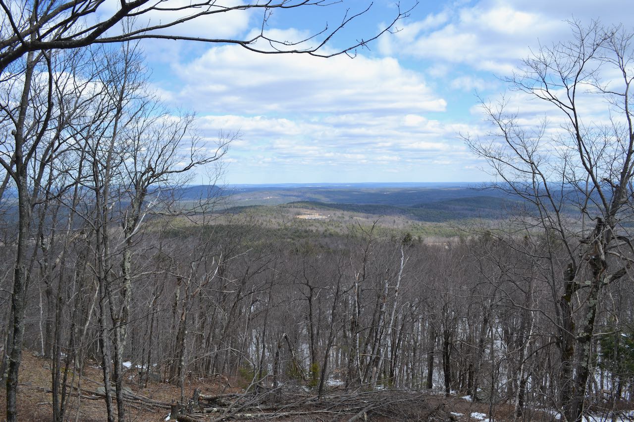
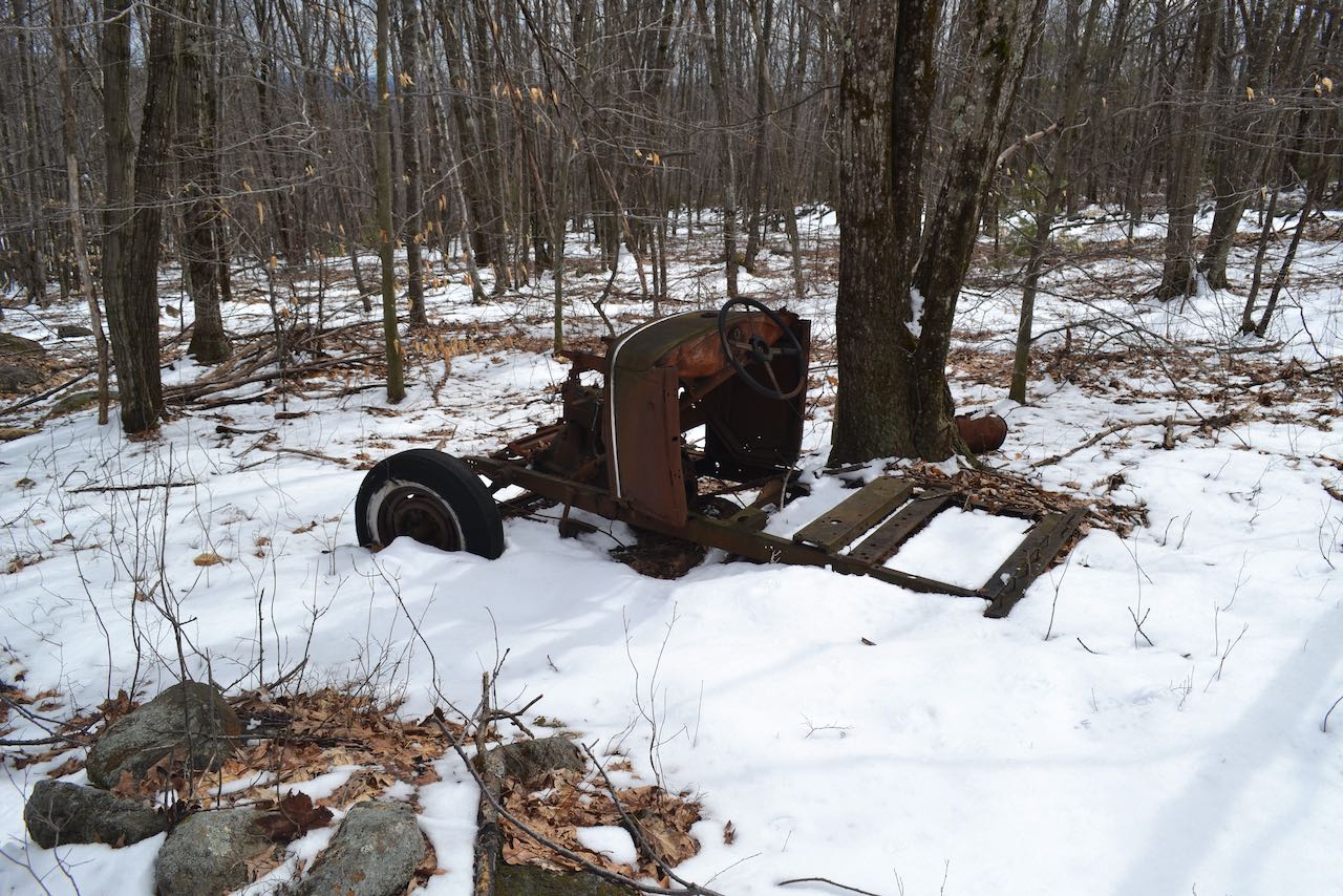
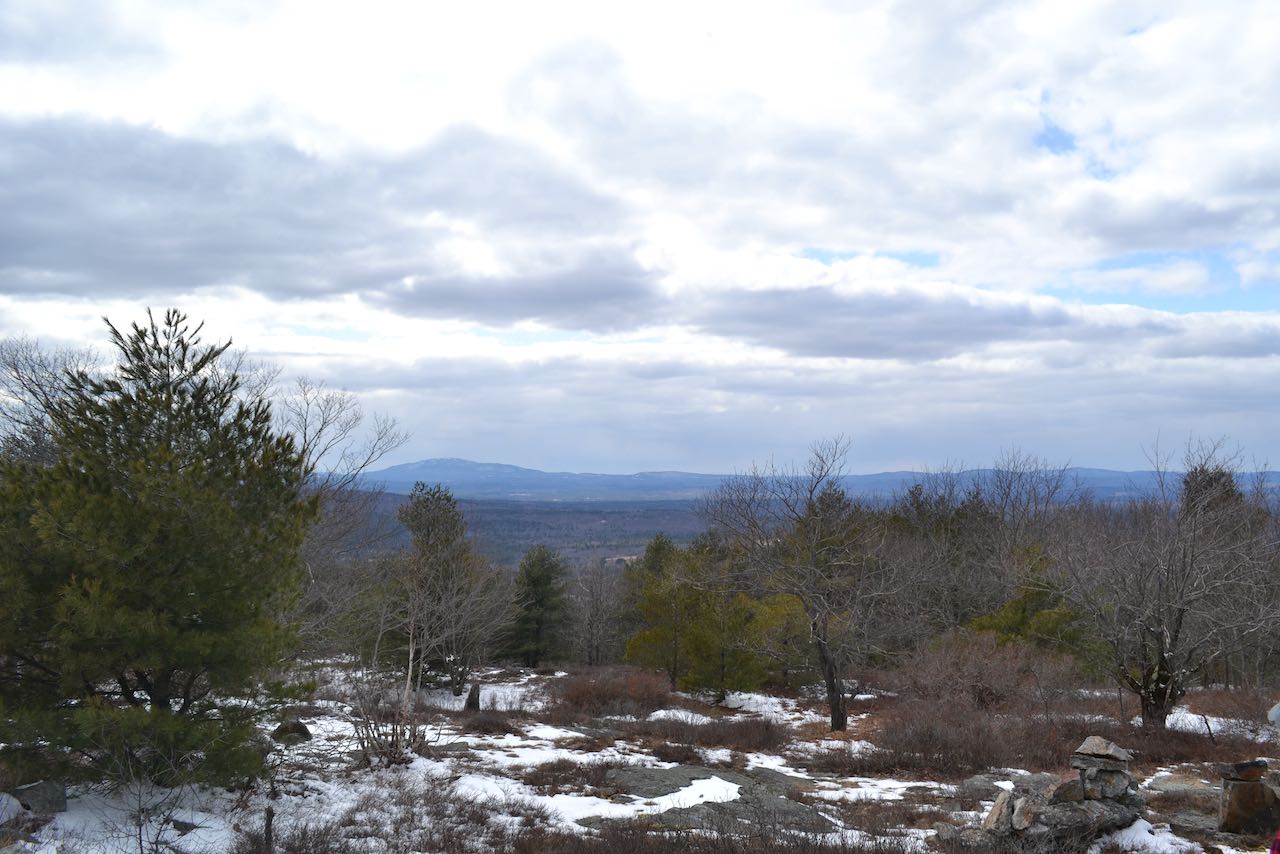
From here you will pick up a snowmobile trail to follow across the ridge. It descends from the left side of the clearing quickly into the woods, passing by the other end of the loop trail after just 0.05 miles. Remember this junction on the way back, as you can use this trail to bypass climbing back over The Pinnacle and follow it a quarter mile back to the first split. You could also turn back here and skip visiting the summit of Rose for a shorter adventure. Past this, the snowmobile trail makes a round 180-degree turn and crosses to the other side of the ridge, making another long curve to continue to the west. A minor brook is crossed, and after 0.4 miles, you will encounter another junction where a secondary path turns right and leads not far up to a ledgy area on a rise in the middle of the ridge between Rose and Pinnacle known as Lyndeborough Mountain. There are no distant views to be found from this spot, so you can pass by it without missing anything. Continue straight on the snowmobile trail across yet more flat terrain as it makes a diagonal back toward the north side of the ridge. In 0.35 miles, the trail continues its pattern of excessive windiness and swings back to the south, running across the pass between the two mountains. In the open forest, you can see the sharper slopes leading up to the summit rise to your right as you walk along the base of it. Stone walls criss-cross the forest. As you round the bend to the south side of the mountain, the trail passes by an automobile fragment. At the end of another tedious 0.4 mile stretch, the snowmobile trail finally makes its last turn back to the right and heads toward the summit. After crossing another stone wall, it breaks out into an open meadow similar to the environment back on The Pinnacle. You'll reach the highest point after 0.2 miles, but much exploring can be done around the clearing, especially on the north side (across from where you came up), where the ledges trail off downhill to reveal clearer views. With some wandering around, views can be enjoyed in most directions. One break in the trees to the south reveals a view across nearby Winn Mountain to the ski slopes of Mt. Wachusett (left) and the southern end of the Wapack Range at Mt. Watatic (right). Off to the southwest, the two Pack Monadnocks loom large. Mt. Monadnock can be seen as before, as well as more of the terrain to the northwest, which includes Skatutakee and Thumb Mountains, Osgood Hill, and Bald Mountain. From the openings off to the north, past the view of Crotched Mountain and Sunapee, you can see a great profile of the White Mountains, as well as the Belknap and Ossipee Ranges. Views to the east are harder to find, but some features can be seen through the trees.
Printable directions page